
|
Former
Flying Site Location
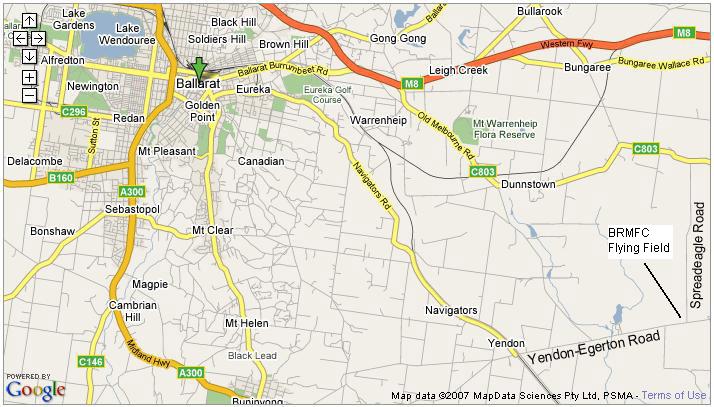
Our previous flying site was located at the corner of Spreadeagle and Yendon-Egerton Roads
Yendon, 18kms by road ESE of Ballarat, Victoria, Australia. The information on
this page is retained for historical purposes only.
It was the home of BRMFC from 1st August 2000 until 31st
October 2014.
How to get there from?
If you are coming from Ballarat:
- Go out Eureka Street which becomes Navigators Road until you reach Yendon (about
12km) then turn left into Yendon-Egerton Road cross the Ballarat-Geelong railway
line and proceed east along the Yendon-Egerton Road for a distance of 5.2km.
(Thats what the GPS says!)
-
Turn left into Spreadeagle Road (unsealed and road name is stencilled on the
drainage culvert) and proceed for about 400m where you
will see the entry gate on your left. (There should be a road sign at Spreadeagle
Road but unfortunately it seems to disappear on a regular basis.) If the gate is
closed please close it after you enter.
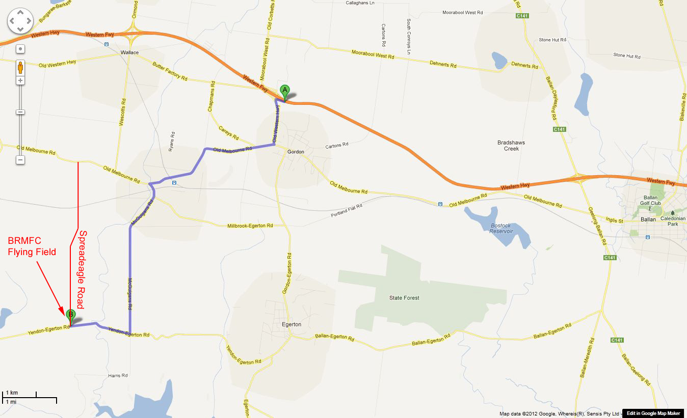
If you are coming from Melbourne:
- Take the Gordon exit off the Western Freeway. (12.7 km to our field)
- At the T intersection turn
left and follow Brougham St/Old Western Highway into Gordon (1.4 km).
- When you reach the Old Melbourne Road at Gordon turn
right and continue 4.2km to McGuigans Road.
- Turn left onto McGuigans
Road (It's a sharp left hander, you'll see the new railway bridge.)
- Follow McGuigans Road for 4.8 km - it runs into Yendon-Egerton Road.
- Turn right into Yendon-Egerton Road and proceed another 1.8 km through the deep ravine
where the road crosses the upper reaches of the Moorabool river (Take particular care through
that section, the speed warning sign means it).
- Turn right
into Spreadeagle Road (unsealed, there's no road sign any more, the
road name is painted on the side of the culvert) and proceed for about 500m where you will see the
entry gate on your left. If the gate is closed please close it after you enter.
Please Note: Whilst these roads are sealed with the exception of the
last stretch up Spreadeagle Road they are just minor roads and are not suitable
for high speed - 60-80km/h is ample.
If you are coming from Geelong:
- Turn off the Midland Highway at Clarendon on the road to Lal Lal. Alternatively
turn off the Midland Highway back at Elaine on the road to Lal Lal (it must be shorter
but a lesser road).
- Cross over the railway line at Lal Lal and turn left. The
road runs along the east side of the railway line to Yendon.
- Turn right into
the Yendon-Egerton Road and proceed east for a distance of 5km.
- Turn left into
Spreadeagle Road (unsealed) and proceed for about 400m where you will see the entry
gate on your left. (There should be a road sign at Spreadeagle Road but unfortunately
it seems to disappear on a regular basis.) If the gate is closed please close it
after you enter.
|